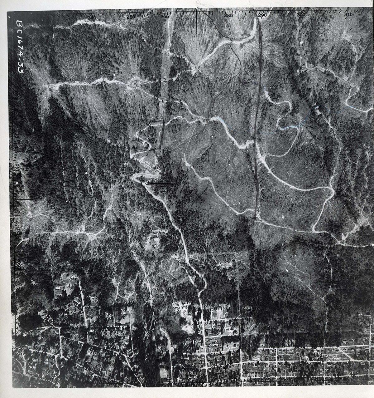
22nd Street to 29th Street / Hollyburn Ridge to Mathers Avenue orthophoto
https://archives.westvancouver.ca/link/descr14344
- Fonds / Collection
- District of West Vancouver fonds
- Description Level
- Item
- GMD
- cartographic material
- Date
- April 14, 1954
- Scope and Content
- Item is an orthophoto of the territory between 22nd Street and 29th Street, from Hollyburn Ridge to Mathers Avenue.
- Repository
- West Vancouver Archives
- Fonds / Collection
- District of West Vancouver fonds
- Description Level
- Item
- Date
- April 14, 1954
- Scope and Content
- Item is an orthophoto of the territory between 22nd Street and 29th Street, from Hollyburn Ridge to Mathers Avenue.
- Physical Description
- 1 orthophoto : b&w ; 25 x 25 cm
- Reference Code
- BC.1674.33.DWV
- Item Number
- BC.1674.33.DWV
- Geographic Access
- Altamont (West Vancouver, B.C.)
- Dundarave (West Vancouver, B.C.)
- Hollyburn Ridge (West Vancouver, B.C.)
- Panorama (West Vancouver, B.C.)
- Upper Lands (West Vancouver, B.C.)
- Whitby Estates (West Vancouver, B.C.)
- Learn More
- Learn more about the above place(s)
- Notes
- Title based on the contents of the image.
- One border of the photograph has been cropped.
- Copyright / Terms of Use
- Public domain. No restrictions on access or reproduction.
- Repository
- West Vancouver Archives
- Publication
- Victoria : Air Division, Department of Lands & Forests
- Other Formats
- Also available as a TIF (24.2 MB).
Images