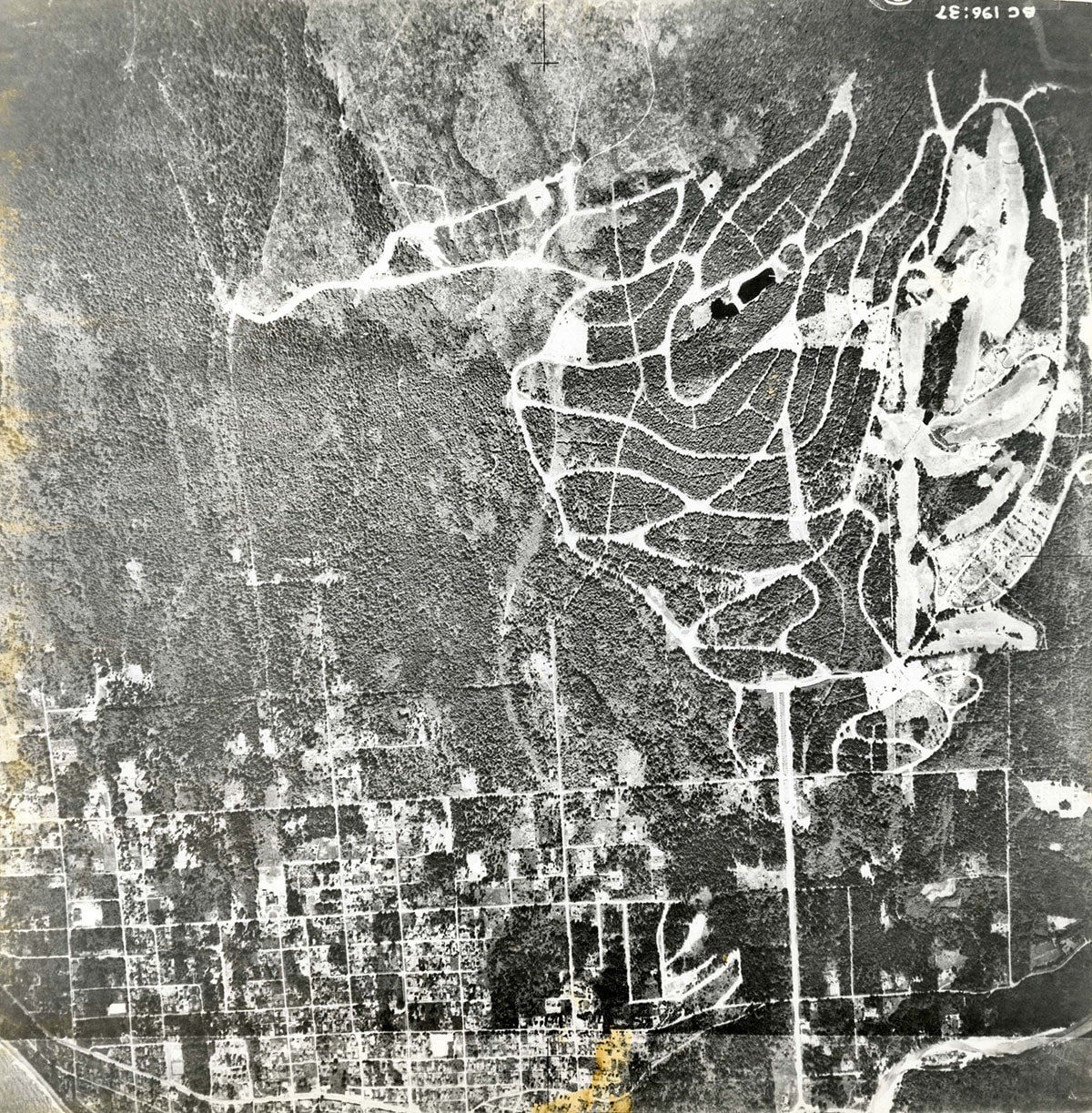
26th Street to Cedardale / British Properties to Marine Drive orthophoto
https://archives.westvancouver.ca/link/descr4317
- Fonds / Collection
- District of West Vancouver fonds
- Description Level
- Item
- GMD
- cartographic material
- Date
- June 27, 1940
- Scope and Content
- Item is a copy of an orthophoto of the territory between 26th Street and Cedardale, the British Properties and Marine Drive.
- Repository
- West Vancouver Archives
- Fonds / Collection
- District of West Vancouver fonds
- Description Level
- Item
- Date
- June 27, 1940
- Scope and Content
- Item is a copy of an orthophoto of the territory between 26th Street and Cedardale, the British Properties and Marine Drive.
- Physical Description
- 1 orthophoto : b&w ; 23 x 23 cm
- Reference Code
- BC.196.37.DWV
- Item Number
- BC.196.37.DWV
- Responsibility
- British Columbia Department of the Environment
- Name Access
- Capilano Estates
- Geographic Access
- Ambleside (West Vancouver, B.C.)
- British Properties (West Vancouver, B.C.)
- Cedardale (West Vancouver, B.C.)
- Hollyburn (West Vancouver, B.C.)
- Sentinel Hill (West Vancouver, B.C.)
- Taylor Way (West Vancouver, B.C.)
- Learn More
- Learn more about the above place(s)
- Notes
- Title based on the contents of the image.
- Copyright / Terms of Use
- Public domain. No restrictions on access or reproduction.
- Repository
- West Vancouver Archives
- Other Formats
- Also available as a TIF (32.7 MB).
Images