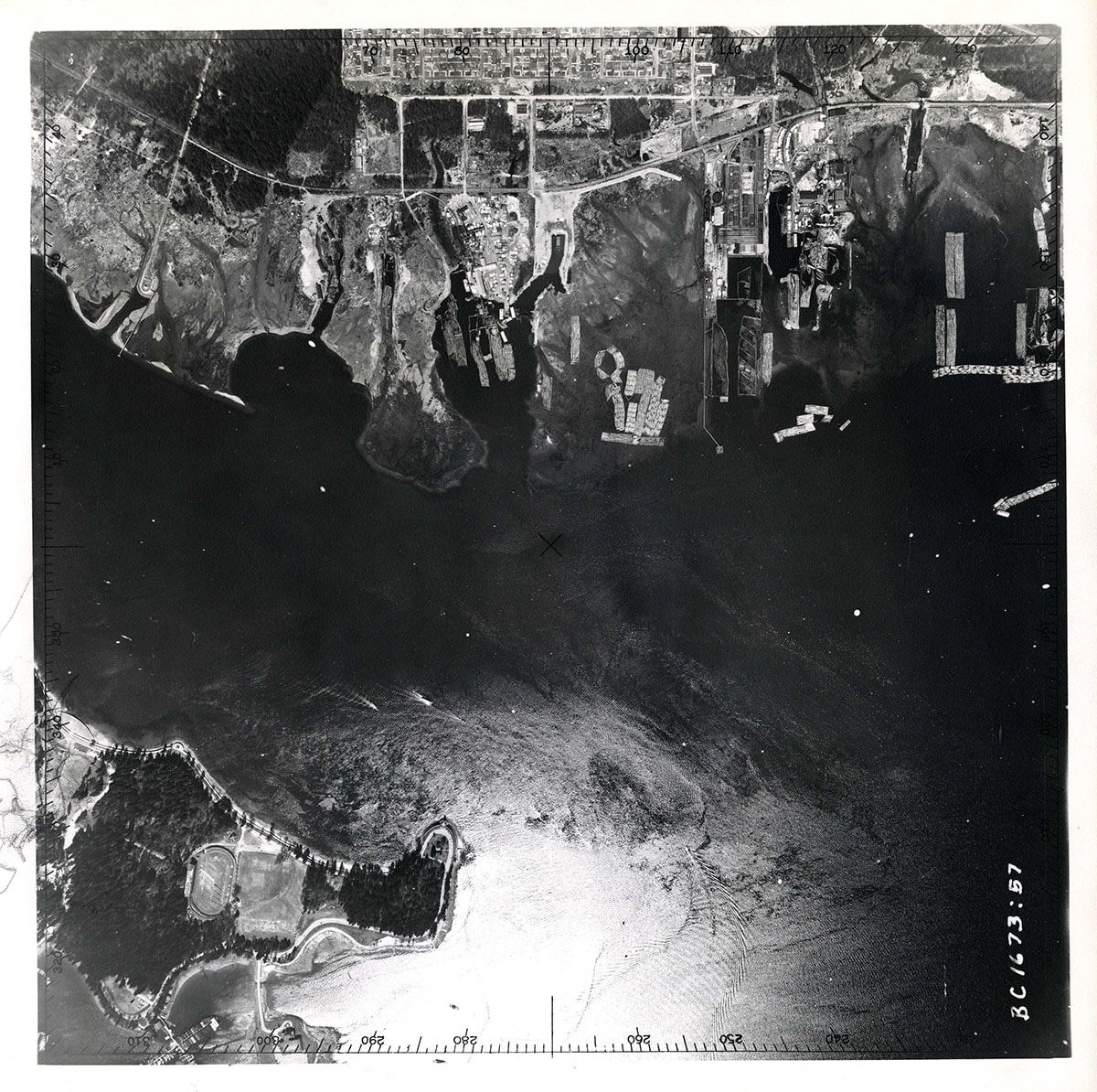
Coal Harbour to Norgate / Lumberman's Arch in Stanley Park to Lower Londsdale orthophoto
https://archives.westvancouver.ca/link/descr4602
- Fonds / Collection
- District of West Vancouver fonds
- Description Level
- Item
- GMD
- cartographic material
- Date
- April 14, 1954
- Scope and Content
- Item is an orthophoto of Vancouver Harbour from Coal Harbour and Lumberman's Arch in Stanley Park to the North Vancouver waterfront and Norgate housing development. Log booms and mills are clearly evident on the North Vancouver waterfront.
- Repository
- West Vancouver Archives
- Fonds / Collection
- District of West Vancouver fonds
- Description Level
- Item
- Date
- April 14, 1954
- Scope and Content
- Item is an orthophoto of Vancouver Harbour from Coal Harbour and Lumberman's Arch in Stanley Park to the North Vancouver waterfront and Norgate housing development. Log booms and mills are clearly evident on the North Vancouver waterfront.
- Physical Description
- 2 orthophotos : b&w ; 25 x 25 cm
- Reference Code
- BC.1673.57.DWV
- Item Number
- BC.1673.57.DWV
- Geographic Access
- Coal Harbour (Vancouver, B.C.)
- Norgate (North Vancouver, B.C.)
- Stanley Park (Vancouver, B.C.)
- Vancouver Harbour (B.C.)
- Learn More
- Learn more about the above place(s)
- Notes
- Title based on the contents of the image.
- Copyright / Terms of Use
- Public domain. No restrictions on access or reproduction.
- Repository
- West Vancouver Archives
- Publication
- Victoria : Air Division, Department of Lands & Forests
- Other Formats
- Also available as a TIF (26.2 MB)
Images