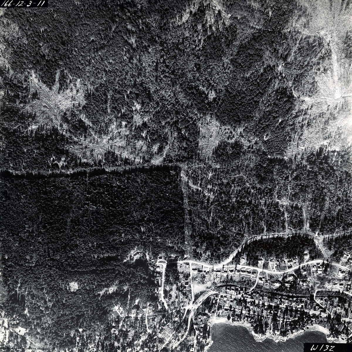
31st Street to McKechnie Park / Cypress Bowl Road to West Bay orthophoto
https://archives.westvancouver.ca/link/descr4701
- Fonds / Collection
- District of West Vancouver fonds
- Description Level
- Item
- GMD
- cartographic material
- Date
- February 22, 1951
- Scope and Content
- Item is an orthophoto of the territory between 31st Street and McKechnie Park, from Cypress Bowl Road to West Bay.
- Repository
- West Vancouver Archives
- Fonds / Collection
- District of West Vancouver fonds
- Description Level
- Item
- Date
- February 22, 1951
- Scope and Content
- Item is an orthophoto of the territory between 31st Street and McKechnie Park, from Cypress Bowl Road to West Bay.
- Physical Description
- 2 orthophotos : b&w ; 23 x 23 cm
- Reference Code
- 166.12.3.11.DWV
- Item Number
- 166.12.3.11.DWV
- Geographic Access
- Upper Lands (West Vancouver, B.C.)
- West Bay (West Vancouver, B.C.)
- Westmount (West Vancouver, B.C.)
- Learn More
- Learn more about the above place(s)
- Notes
- Title based on the contents of the image.
- Secondary numeric designation on lower right corner of photograph W132.
- Copyright / Terms of Use
- Public domain. No restrictions on access or reproduction.
- Repository
- West Vancouver Archives
- Publication
- Ottawa : Fisheries & Marine Service
- Other Formats
- Also available as a TIF (25.7 MB).
Images