Coast Line, Caulfeild BC
https://archives.westvancouver.ca/link/descr9747
- Fonds / Collection
- Caulfeild family fonds
- Description Level
- Item
- GMD
- photograph
- Date
- [ca. 1932] (date of original), copied 1996
- Scope and Content
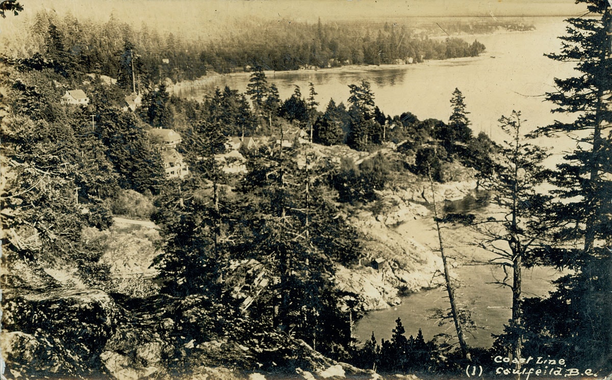
- Item is a photograph of the Caulfeild shoreline, viewed east from a high bluff in Lighthouse Park.
- Repository
- West Vancouver Archives
- Fonds / Collection
- Caulfeild family fonds
- Description Level
- Item
- GMD
- photograph
- Date
- [ca. 1932] (date of original), copied 1996
- Scope and Content
- Item is a photograph of the Caulfeild shoreline, viewed east from a high bluff in Lighthouse Park.
- Physical Description
- 1 photograph : b&w copy negative ; 10 x 12 cm
- Reference Code
- CA BWVA F067-S-03IT027
- Item Number
- 027.WVA.CAU
- Accession Number
- 1996-023
- 2009-116
- Creator
- Caulfeild (family)
- Subject Access
- Geographic Features - Bays and coves
- Geographic Features - Coasts
- Geographic Access
- Caulfeild (West Vancouver, B.C.)
- Caulfeild Cove (West Vancouver, B.C.)
- Learn More
- Learn more about the above place(s)
- Notes
- Item is a copy stand reproduction of an original loaned to the Archives.
- Annotation on recto: "Coast Line (1), Caulfeild B.C."
- Caption accompanying original: "View of the most developed part of Caulfeild to Eastward from high bluff over the Cove in Point Atkinson Park, called Lighthouse Park. In the foreground the landing stage where coasting steamers used to call which provided the only means of communication with Vancouver and the outside world until the road 'Marine Drive' along the north shore of the harbour was constructed a few years ago and the P.G.E. Rly [railway] from Vancouver via Second Narrows bridge, which has however not been running for some years now."
- From an album created by Francis Wade Caulfeild or Wade Toby Caulfeild, ca. 1932.
- Copyright / Terms of Use
- Public domain. No restrictions on access or reproduction.
- Repository
- West Vancouver Archives
- Other Formats
- Also available as a TIF (38.9 MB)
Images